Suche einschränken:
Zur Kasse

5 Ergebnisse.

Remote Sensing of Natural Hazards

Gao, Jay
Remote Sensing of Natural Hazards
This book examines the remote sensing technology used to gather information on 12 types of natural hazards in the terrestrial sphere, biosphere, hydrosphere, and atmosphere. It clarifies how to yield spatial and quantitative data on a natural hazard, including its spatial distribution, severity, causes, and the likelihood of occurrence.

CHF 196.00

Imperium

Gao, Jay
Imperium
Jay Gao's debut collection Imperium introduces a compelling innovative talent.

CHF 21.50

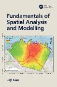
Fundamentals of Spatial Analysis and Modelling

Gao, Jay
Fundamentals of Spatial Analysis and Modelling
This textbook provides comprehensive and in-depth explanations of all topics related to spatial analysis and spatiotemporal simulation, including how spatial data are acquired, represented digitally, and spatially aggregated.

CHF 150.00

Digital Analysis of Remotely Sensed Imagery

Gao, Jay
Digital Analysis of Remotely Sensed Imagery
authenticity, or access to any online entitlements included with the product. Explore the Latest Techniques and Trends in Remotely Sensed Digital Image Analysis!Written in easy-to-follow language with a minimum of technical jargon, Digital Analysis of Remotely Sensed Imageryprovides exhaustive coverage of the entire process of analyzing remotely sensed data for the purpose of producing accurate representations in thematic map format. The book ...

CHF 199.00