Dartford & Gravesend A-Z Street Atlas
Geographers' A-Z Map Co Ltd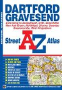
This street atlas of Dartford, Gravesend, Bexleyheath, Erith, Northfleet, Sidcup and Swanley features 30 pages of coloured mapping that extends to:

Keine Beschreibung.
Keine Beschreibung.
Keine Beschreibung.
Keine Beschreibung.
Keine Beschreibung.

Keine Beschreibung.
Keine Beschreibung.
Keine Beschreibung.
Keine Beschreibung.