Suche einschränken:
Zur Kasse

151 Ergebnisse - Zeige 1 von 20.

World Executive, Mural Flat

Maps, National Geographic
World Executive, Mural Flat
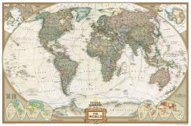
National Geographic Wall Maps offer a special glimpse into current and historical events, and they inform about the world and environment. Offered in a variety of styles and formats, these maps are excellent reference tools and a perfect addition to any home, business or school. There are a variety of map options to choose from, including the world, continents, countries and regions, the United States, history, nature and space.

CHF 215.00

North Fork Range, Deadwood River Map

Maps, National Geographic
North Fork Range, Deadwood River Map
- Waterproof - Tear-Resistant - Topographic MapNational Geographic's North Fork Range, Deadwood River Trails Illustrated map spans the heart of the Boise National Forest between Boise and McCall, Idaho, encompassing the North Fork Range and West Mountains on its west side, and the Salmon River Mountains to the east. This spectacular region of mountain peaks, ridges, and valleys is trisected by the North, Middle, and South Forks of the Payette ...

CHF 27.90

Boise, Trinity Mountain Map

Maps, National Geographic
Boise, Trinity Mountain Map
- Waterproof - Tear-Resistant - Topographic MapThe playground of trails and outdoor recreation areas north and east of Boise, Idaho is among the best of any city in North America. National Geographic's Boise, Trinity Mountain Trails Illustrated Map features the Ridge to Rivers Trail System and the local parks accessible from downtown Boise, including a detailed trail chart. Beyond this local trail system, the map features the extensive multi-s...

CHF 27.90

Appalachian Trail: Virginia, West Virginia, Maryland [map...

Maps, National Geographic
Appalachian Trail: Virginia, West Virginia, Maryland [map Pack Bundle]
- Waterproof - Tear-Resistant - Topographic MapsThe Appalachian Trail (AT) Map Pack Bundle of Virginia, West Virginia, Maryland includes three Topographic Map Guides that cover the AT from the Tennessee-Virginia state line to the southern border of Pennsylvania. Of the 14 states that the AT travels through Virginia has the longest section at over 500 miles. Each AT Topographic Map Guide includes detailed topographic maps at a detail of 1 inch ...

CHF 65.00

Kenai Fjords National Park

Maps, National Geographic
Kenai Fjords National Park
This Trails Illustrated topographic map for Kenai Fjords National Park in southern Alaska, where in a given day you can see whales, bears, and ice worms. The map includes Kenai Fjords National Park, Kenai national Wildlife Refuge, Chugach National Forest, Harding Icefield, Nuka Island, Kachemak Bay State Park, Ragged Islands, Pye Islands, and more.

CHF 23.50