The Annandale Way is a splendid walk in a little-known but accessible part of southern Scotland. It starts in Moffat and runs for 56 miles (90 km) via Lochmaben to reach the Solway Firth at Newbiebarns. A shorter branch goes via Lockerbie and Eskrigg Nature Reserve. There are superb views, wildlife and heritage - one of Scotland's Great Trails.
The Friends Way is a 62-mile walk in northern England that starts near Pendle Hill and passes through fine parts of the Yorkshire Dales to end at Sedbergh. It combines glorious scenery with superb wildlife and striking geology, and visits key places in George Fox's journey of 1652 that led to the creation of the Quaker movement.
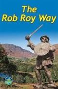
Revised fourth edition of guidebook for a Way linked with Scotland's most famous outlaw, Rob Roy MacGregor. It runs through the Highlands, with superb views, wildlife, history and heritage. The book helps walkers and cyclists to plan and enjoy a week's following in the footsteps of Rob Roy with detailed new mapping at 1:50, 000.
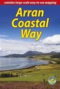
The Arran Coastal Way is one of Scotland's Great Trails running for 65 miles around the island. It's accessible from Glasgow via the Ardrossan ferry. Famous as`Scotland in miniature', Arran is rich in scenery, castles, caves and standing stones. The walking is varied, the wildlife uniquely approachable, and its residents welcoming. Updated in 2021.
The Speyside Way runs for 85 miles from the fishing port of Buckie to Newtonmore in the Cairngorm National Park. This edition has large-scale mapping at 1:42, 500, and plans of villages en route. It contains all you need to enjoy your walk with detailed directions, distance, terrain and refreshments. With 103 colour photos it makes a fine souvenir.
The Wicklow Way is Ireland's first and most popular waymarked long-distance walk, running 81 miles (130 km) between Dublin and Clonegal, with varied and scenic walking on the flanks of the Wicklow mountains. This third edition provides detailed mapping, many updates and 95 colour photos.
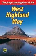
The West Highland Way is the first and most famous of Scotland's Great Trails, running for 96 miles (154 km) through superb scenery. Starting from the outskirts of Glasgow, it passes through Scotland's first National Park, along the banks of Loch Lomond, across the wilds of Rannoch Moor and ends in Fort William at the foot of Ben Nevis, Britain's highest mountain. This new edition describes the route from Milngavie northward, including the imp...
The Great Glen Way follows Scotland's historic Great Glen between Fort William and Inverness for 77 miles (124 km). The sixth edition of this guidebook is for cyclists as well as walkers. It has fresh mapping covering all route options at large scale, with many updates and new photos.
The West Highland Way is Scotland's premier long-distance walk, running 96 miles (155 km) from Glasgow to Fort William. This rainproof guidebook, fully revised for 2020, has all you need to plan and enjoy your holiday. It includes route description, background on Loch Lomond, history and wildlife, route mapping at 1:42, 500, and 120 colour photos.
The 65-mile Arran Coastal Way is one of Scotland's Great Trails. Arran is famous as 'Scotland in miniature', its coast rich in scenery and wildlife. This guidebook has all you need: route description, pre-history and history, whisky-making and wildlife, large-scale mapping, public transport and travel, 125 colour photos, printed on rainproof paper.
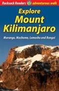
At 5895 metres (nearly 4 miles) above sea level, the summit of Mount Kilimanjaro is the highest point on earth that a walker can reach. The author explains how to maximise your chances of summiting enjoyably by a wise choice of route, thorough preparation and taking care of yourself on the mountain.
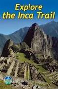
The third edition of our popular guidebook contains everything you need to plan and enjoy hiking a choice of three Inca Trails to Machu Picchu in Peru. It has been revised for 2011 with fresh photographs and updated information. Step-by-step sections cover the Classic trail (4-5 days), the longer, more strenuous trek from Mollepata (6-7 days) and the Shortest option (2 days).