Suche einschränken:
Zur Kasse

2889 Ergebnisse - Zeige 2841 von 2860.

Toot and Puddle: The Great Cheese Chase

National Geographic
Toot and Puddle: The Great Cheese Chase
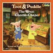
Come with Toot and Puddle as they set off from home in Woodcock Pocket to visit Paris and discover all things French--especially the yummy cuisine. "The Great Cheese Chase" is on! They first spot chocolate...then blueberry crepes...mmmm...almond croissants...and mmmmmmm, macaroons! When they finally arrive at Le Chateau de Fromage they are TOO FULL FOR FROMAGE! So Toot and Puddle decide to take some back to friends. But why is it half-eaten wh...

CHF 14.90

Dinosaur Museum, The

National Geographic Society
Dinosaur Museum, The
Young, eager paleontologists wanted. Apply within. We need YOUR expertise! So step inside "The Dinosaur Museum, " the book where kids get to act like paleontologists. This amazing volume gives readers a behind-the-scene

CHF 25.90

National Geographic Kids Almanac 2012

National Geographic Kids
National Geographic Kids Almanac 2012
Check out the world's best-selling National Geographic Kids 2012 Almanac, No. 3 on The New York Times Best Sellers list for Children's Paperbacks. In the lively style of National Geographic Kids magazine, this colorful page-turner excites young people about their world and everything in it. The National Geographic Kids 2012 Almanac-also available in Canadian and International editions-is packed with fun-to-browse features, useful reference mat...

CHF 24.90

10 Best of Everything National Parks, The

National Geographic
10 Best of Everything National Parks, The
National parks are more than the best idea America ever had—they're our country's best playgrounds for millions of vacationers who want to enjoy recreation activities, nature and wildlife, and down-time with friends, family, or as solo travelers. This timely, idea-filled guide covers "classic" parks, national historical parks, national monuments, national battlefields, national scenic trails, and beyond. Hundreds of Top 10 lists highlight ever...

CHF 28.90

Gospel of Judas, The

National Geographic Society
Gospel of Judas, The
For 1, 600 years its message lay hidden. When the bound papyrus pages of this lost gospel finally reached scholars who could unlock its meaning, they were astounded. Here was a gospel that had not been seen since the early days of Christianity, and which few experts had even thought existed-a gospel told from the perspective of Judas Iscariot, history's ultimate traitor. And far from being a villain, the Judas that emerges in its pages is a he...

CHF 26.90

Carlsbad Caverns National Park Map

National Geographic Maps
Carlsbad Caverns National Park Map
National Geographic's Trails Illustrated Maps are the most detailed and up-to-date topographic recreation maps available for US National Parks, National Forests and other popular outdoor recreation areas. A necessity for exploring the outdoors, each map is printed on waterproof, tear-resistant material. They also contain key safety and contact information, GPS and compass coordinates, Leave No Trace ethical guidelines and hundreds of points-of...

CHF 22.90

Hoosier National Forest Map

National Geographic Maps
Hoosier National Forest Map
Coverage includes Patoka Lake State Reservoir, Harrison Crawford State Forest, Ohio River, Yellowbank State Wildlife Management Area, Brown County State Park, Martin State Forest, insets of Two Lakes and German Ridge. Towns include Tell City, Bloomington, Mitchell, Paoli, Orleans, French Lick. Includes UTM grids for use with your GPS unit.

CHF 22.90

Apostle Islands National Lakeshore Map

National Geographic Maps
Apostle Islands National Lakeshore Map
National Geographic's Trails Illustrated Maps are the most detailed and up-to-date topographic recreation maps available for US National Parks, National Forests and other popular outdoor recreation areas. A necessity for exploring the outdoors, each map is printed on waterproof, tear-resistant material. They also contain key safety and contact information, GPS and compass coordinates, Leave No Trace ethical guidelines and hundreds of points-of...

CHF 22.90

Indian Peaks, Gold Hill Map

National Geographic Maps
Indian Peaks, Gold Hill Map
Coverage includes Roosevelt and Arapaho national forests, Indian Peaks Wilderness, Arapaho National Recreation Area, Tabernash, Fraser, Nederland, Eldora, Ward, Peaceful Valley, Lake Granby, Barker and Beaver reservoirs, Pawnee, Arapaho and Rollins passes. Devils Thumb cross-country ski area. Includes UTM grids for use with your GPS unit.

CHF 22.90

Tahoe National Forest East Map [Sierra Buttes, Donner Pass]

National Geographic Maps
Tahoe National Forest East Map [Sierra Buttes, Donner Pass]
National Geographic's Trails Illustrated Maps are the most detailed and up-to-date topographic recreation maps available for US National Parks, National Forests and other popular outdoor recreation areas. A necessity for exploring the outdoors, each map is printed on waterproof, tear-resistant material. They also contain key safety and contact information, GPS and compass coordinates, Leave No Trace ethical guidelines and hundreds of points-of...

CHF 22.90

Moab South

National Geographic Maps - Trails Illust
Moab South
National Geographic's Trails Illustrated Maps are the most detailed and up-to-date topographic recreation maps available for US National Parks, National Forests and other popular outdoor recreation areas. A necessity for exploring the outdoors, each map is printed on waterproof, tear-resistant material. They also contain key safety and contact information, GPS and compass coordinates, Leave No Trace ethical guidelines and hundreds of points-of...

CHF 23.50

Mount Rogers National Recreation Area Map [Jefferson Nati...

National Geographic Maps
Mount Rogers National Recreation Area Map [Jefferson National Forest]
National Geographic's Trails Illustrated Maps are the most detailed and up-to-date topographic recreation maps available for US National Parks, National Forests and other popular outdoor recreation areas. A necessity for exploring the outdoors, each map is printed on waterproof, tear-resistant material. They also contain key safety and contact information, GPS and compass coordinates, Leave No Trace ethical guidelines and hundreds of points-of...

CHF 22.90

Cedar City, Markagunt Plateau Map

National Geographic Maps
Cedar City, Markagunt Plateau Map
Coverage includes Dixie National Forest, Ashdown Gorge Wilderness, Cedar Breaks National Monument, Brian Head, Navajo Lake, Haycock Mountain, Panguitch Lake, Long Valley Junction and Duck Creek. Includes UTM grids for use with your GPS unit.

CHF 22.90

Joshua Tree National Park Map

National Geographic Maps
Joshua Tree National Park Map
National Geographic's Trails Illustrated Maps are the most detailed and up-to-date topographic recreation maps available for US National Parks, National Forests and other popular outdoor recreation areas. A necessity for exploring the outdoors, each map is printed on waterproof, tear-resistant material. They also contain key safety and contact information, GPS and compass coordinates, Leave No Trace ethical guidelines and hundreds of points-of...

CHF 22.90

Merced and Tuolumne Rivers Map [Stanislaus National Forest]

National Geographic Maps
Merced and Tuolumne Rivers Map [Stanislaus National Forest]
National Geographic's Trails Illustrated Maps are the most detailed and up-to-date topographic recreation maps available for US National Parks, National Forests and other popular outdoor recreation areas. A necessity for exploring the outdoors, each map is printed on waterproof, tear-resistant material. They also contain key safety and contact information, GPS and compass coordinates, Leave No Trace ethical guidelines and hundreds of points-of...

CHF 22.90

Santa Monica Mountains National Recreation Area Map

National Geographic Maps
Santa Monica Mountains National Recreation Area Map
National Geographic's Trails Illustrated Maps are the most detailed and up-to-date topographic recreation maps available for US National Parks, National Forests and other popular outdoor recreation areas. A necessity for exploring the outdoors, each map is printed on waterproof, tear-resistant material. They also contain key safety and contact information, GPS and compass coordinates, Leave No Trace ethical guidelines and hundreds of points-of...

CHF 22.90