Suche einschränken:
Zur Kasse

2889 Ergebnisse - Zeige 21 von 40.

Mount Hood Map [Mount Hood and Willamette National Forests]

National Geographic Maps
Mount Hood Map [Mount Hood and Willamette National Forests]
National Geographic's Trails Illustrated Maps are the most detailed and up-to-date topographic recreation maps available for US National Parks, National Forests and other popular outdoor recreation areas. A necessity for exploring the outdoors, each map is printed on waterproof, tear-resistant material. They also contain key safety and contact information, GPS and compass coordinates, Leave No Trace ethical guidelines and hundreds of points-of...

Great Smoky Mountains National Park East: Clingmans Dome,...

National Geographic Maps
Great Smoky Mountains National Park East: Clingmans Dome, Cataloochee Map
National Geographic's Trails Illustrated Maps are the most detailed and up-to-date topographic recreation maps available for US National Parks, National Forests and other popular outdoor recreation areas. A necessity for exploring the outdoors, each map is printed on waterproof, tear-resistant material. They also contain key safety and contact information, GPS and compass coordinates, Leave No Trace ethical guidelines and hundreds of points-of...

Springer and Cohutta Mountains Map [Chattahoochee Nationa...

National Geographic Maps
Springer and Cohutta Mountains Map [Chattahoochee National Forest]
National Geographic's Trails Illustrated Maps are the most detailed and up-to-date topographic recreation maps available for US National Parks, National Forests and other popular outdoor recreation areas. A necessity for exploring the outdoors, each map is printed on waterproof, tear-resistant material. They also contain key safety and contact information, GPS and compass coordinates, Leave No Trace ethical guidelines and hundreds of points-of...

Ozark National Scenic Riverways Map

National Geographic Maps
Ozark National Scenic Riverways Map
National Geographic's Trails Illustrated Maps are the most detailed and up-to-date topographic recreation maps available for US National Parks, National Forests and other popular outdoor recreation areas. A necessity for exploring the outdoors, each map is printed on waterproof, tear-resistant material. They also contain key safety and contact information, GPS and compass coordinates, Leave No Trace ethical guidelines and hundreds of points-of...

Eagle, Avon Map

National Geographic Maps
Eagle, Avon Map
National Geographic's Trails Illustrated Maps are the most detailed and up-to-date topographic recreation maps available for US National Parks, National Forests and other popular outdoor recreation areas. A necessity for exploring the outdoors, each map is printed on waterproof, tear-resistant material. They also contain key safety and contact information, GPS and compass coordinates, Leave No Trace ethical guidelines and hundreds of points-of...

Boulder, Golden Map

National Geographic Maps
Boulder, Golden Map
National Geographic's Trails Illustrated Maps are the most detailed and up-to-date topographic recreation maps available for US National Parks, National Forests and other popular outdoor recreation areas. A necessity for exploring the outdoors, each map is printed on waterproof, tear-resistant material. They also contain key safety and contact information, GPS and compass coordinates, Leave No Trace ethical guidelines and hundreds of points-of...

Fontana and Hiwassee Lakes Map [Nantahala National Forest]

National Geographic Maps
Fontana and Hiwassee Lakes Map [Nantahala National Forest]
National Geographic's Trails Illustrated Maps are the most detailed and up-to-date topographic recreation maps available for US National Parks, National Forests and other popular outdoor recreation areas. A necessity for exploring the outdoors, each map is printed on waterproof, tear-resistant material. They also contain key safety and contact information, GPS and compass coordinates, Leave No Trace ethical guidelines and hundreds of points-of...

Las Vegas Map

National Geographic Maps
Las Vegas Map
In addition to the easy-to-read map on the front, the back includes: - Regional map - Points of interest - Inset map of Downtown Las Vegas - Airport diagram - Information for Grand Canyon and Bryce Canyon National Parks - Multi-language legend.

Delmarva Peninsula Map

National Geographic Maps
Delmarva Peninsula Map
National Geographic's Trails Illustrated Maps are the most detailed and up-to-date topographic recreation maps available for US National Parks, National Forests and other popular outdoor recreation areas. A necessity for exploring the outdoors, each map is printed on waterproof, tear-resistant material. They also contain key safety and contact information, GPS and compass coordinates, Leave No Trace ethical guidelines and hundreds of points-of...

Acadia National Park Map

National Geographic Maps
Acadia National Park Map
Updated to reflect road closings, new trails, and campground relocation, and includes detailed trail information, points of interest, trailheads, picnic areas, facitlities, and more. Features Mount Desert Island, Sestern Mountain, Norwood Ridge, Freeman Ridge, Isle au Haut, Marshall Island, Swans Island, Western Bay, Mount Desert Narrows, Eastern May, Frenchman Bay, Eastern Way, Eastern Passage, Long Pond, Seal Cove Pond, Echo Lake, Somes Soun...

Grand Staircase, Paunsaugunt Plateau Map [Grand Staircase...

National Geographic Maps
Grand Staircase, Paunsaugunt Plateau Map [Grand Staircase-Escalante National Monument]
- Waterproof - Tear-Resistant - Topographic MapOutdoor enthusiasts seeking to enjoy the abundance of public lands and endless recreational opportunities in southern Utah will marvel at National Geographic's Trails Illustrated map of Grand Staircase and Paunsaugunt Plateau. Created in cooperation with the Bureau of Land Management, U.S. Forest Service, National Park Service and others, this expertly researched map provides unmatched detail betw...

Paria Canyon, Kanab Map [Vermillion Cliffs National Monum...

National Geographic Maps
Paria Canyon, Kanab Map [Vermillion Cliffs National Monument, Grand Staircase-Escalante National Monument]
- Waterproof - Tear-Resistant - Topographic MapStraddling the border of Arizona and Utah, the Paria Canyon-Vermilion Cliffs Wilderness is a colorful landscape of sandstone cliffs, slot canyons, and winding waterways. National Geographic's Trails Illustrated map of Paria Canyon and Kanab is designed to meet the needs of outdoor enthusiasts by combining valuable information with unmatched detail of this remarkable region. Created in partnership ...

Baja South: Baja California Sur Map [Mexico]

National Geographic Maps
Baja South: Baja California Sur Map [Mexico]
Blicke ins Licht" wendet sich an alle, die sich mit dem Tod und somit mit dem Leben befassen. Benötigen Sie einen tröstlichen Spruch, ein passendes Gedicht? In diesem Buch finden Sie es. "Blicke ins Licht" beinhaltet eine bemerkenswerte Sammlung von Texten, Zitaten und Gedichten zum Tod, d.h. zum Übergang ins Licht. Die Texte aus verschiedensten Zeitepochen zeigen, dass das Leben "danach" auf wundervolle Weise weitergeht. "Blicke ins Licht" sc...

The Civil War

National Geographic
The Civil War
Perfect for tour planning and on-the-ground use, this guide will prove indispensable on any expedition to explore Civil War history in America. Packed with color photographs, more than 600 historic battlefield and additional Civil War related sites, walking tours, 50 detailed maps, and the collective expertise of Civil War historians and dozens of park service experts, this handy, practical guide offers comprehensive information on the more th...

CHF 61.00

Jamaica Map

National Geographic Maps
Jamaica Map
- Waterproof - Tear-Resistant - Travel MapNational Geographic's Jamaica Adventure Map is designed to meet the needs of adventure travelers with its detailed and accurate information. This map includes the locations of cities and towns with a user-friendly index, a clearly marked road network complete with distances and designations for roads/highways, plus secondary routes for those seeking to explore off the beaten path. Adventure Maps differ...

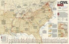
National Geographic Battles of the Civil War Wall Map (35...

National Geographic Maps
National Geographic Battles of the Civil War Wall Map (35.75 X 23.25 In)
This comprehensive map shows major land campaigns, Union and Confederate troop movements, major Union naval campaigns, roads, railroads, battle outcomes and their impacts on the war, dates of capture by Union forces and more. Two inset maps - Battle for the Capitals and Turning Points of the War - as well as a timeline of battles with map location, casualties and impacts of battles are included. Created with the assistance of the National Park...

Northville-Placid Trail Map

National Geographic Maps
Northville-Placid Trail Map
- Waterproof - Tear-Resistant - Topographic MapNational Geographic's Trails Illustrated map of the Adirondack Park, Northville-Placid Trail combines unmatched detail with helpful information to offer an invaluable tool for making the most of your visit to this 130 plus mile long trail. The Northville-Placid Trail (NPT) is the jewel in the crown of the Adirondack Park trail network. The NPT was constructed in 1923 through remote lake country. T...

Cambodia Map

National Geographic Maps
Cambodia Map
- Waterproof - Tear-Resistant - Travel MapNational Geographic's Cambodia Adventure Map is designed to meet the needs of adventure travelers with its detailed and accurate information. This map includes the locations of cities and towns with a user-friendly index, a clearly marked road network complete with distances and designations for roads/highways, plus secondary routes for those seeking to explore off the beaten path. Adventure Maps diffe...