
Columbia River Gorge National Scenic Area Map
National Geographic Maps
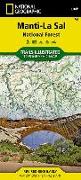
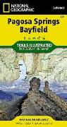
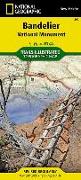
National Geographic's Trails Illustrated Maps are the most detailed and up-to-date topographic recreation maps available for US National Parks, National Forests and other popular outdoor recreation areas. A necessity for exploring the outdoors, each map is printed on waterproof, tear-resistant material. They also contain key safety and contact information, GPS and compass coordinates, Leave No Trace ethical guidelines and hundreds of points-of...
![Mount Baker and Boulder River Wilderness Areas Map [Mt. Baker-Snoqualmie National Forest]](https://support.digitalhusky.com/media/annotations/sorted/108/10860847/CHSBZCOP0310860847.jpg)
![Boundary Waters West Map [Canoe Area Wilderness, Superior National Forest]](https://support.digitalhusky.com/media/annotations/sorted/108/10860845/CHSBZCOP0310860845.jpg)
![Colorado National Monument Map [Mcinnis Canyons National Conservation Area]](https://support.digitalhusky.com/media/annotations/sorted/108/10860825/CHSBZCOP0310860825.jpg)
![French Broad and Nolichucky Rivers Map [Cherokee and Pisgah National Forests]](https://support.digitalhusky.com/media/annotations/sorted/108/10860821/CHSBZCOP0310860821.jpg)
![Boundary Waters East Map [Canoe Area Wilderness, Superior National Forest]](https://support.digitalhusky.com/media/annotations/sorted/108/10860844/CHSBZCOP0310860844.jpg)
![Salt River Canyon Map [Tonto National Forest]](https://support.digitalhusky.com/media/annotations/sorted/108/10860841/CHSBZCOP0310860841.jpg)
![Mazatzal and Pine Mountain Wilderness Areas Map [Coconino, Prescott, and Tonto National Forests]](https://support.digitalhusky.com/media/annotations/sorted/108/10860840/CHSBZCOP0310860840.jpg)
![Tahoe National Forest West Map [Yuba and American Rivers]](https://support.digitalhusky.com/media/annotations/sorted/108/10860833/CHSBZCOP0310860833.jpg)
![High Uintas Wilderness Map [Ashley and Wasatch-Cache National Forests]](https://support.digitalhusky.com/media/annotations/sorted/108/10860816/CHSBZCOP0310860816.jpg)