Suche einschränken:
Zur Kasse

4 Ergebnisse.

Sailing for the East: History and Catalogue of Manuscript...

Schilder, Günter / Kok, Hans
Sailing for the East: History and Catalogue of Manuscript Charts on Vellum of the Dutch East India Company (Voc), 1602-1799
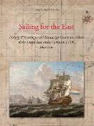
De VOC was voor een periode van 200 jaar verantwoordelijk voor het ter beschikking stellen van navigatiemateriaal voor de vaart tussen Nederland en het Verre Oosten en in het inter-Aziatische handelsverkeer. Met behulp van teruggevonden archivalia wordt een nooit eerder getoond overzicht gegeven van het kaartmateriaal dat op een VOC-schip werd gebruikt. Alle navigatiekaarten van de VOC uit de 17e en 18e eeuw, getekend op perkament (die veelal ...

CHF 320.00

Monumenta Cartographica Neerlandica Volume IX (3 Vols.)

Schilder, Günter
Monumenta Cartographica Neerlandica Volume IX (3 Vols.)
This volume focuses exclusively on the work of Hessel Gerritsz. (c. 1581-1632), who ranks among the most important and influential cartographers of the early-seventeenth-century Amsterdam. He started his career in Willem Jansz. Blaeu's workshop. About 1608 he established himself as an independent engraver, mapmaker and printer. A selection of his maps has been described and reproduced in full size and his position as chart-maker of the Dutch E...

CHF 1453.00

Sailing Across the World's Oceans: History & Catalogue of...

Schilder, Günter / Kok, Hans
Sailing Across the World's Oceans: History & Catalogue of Dutch Charts Printed on Vellum 1580-1725
This illustrated cartobibligraphy describes and analyses about 150 charts, printed by commercial Amsterdam charts publishers between the sixteenth and the eighteenth century. With over 800 full colour illustrations. The first part of the book discusses Amsterdam as a centre for map production and distribution, navigation techniques and the developing world image.

CHF 262.00

Early Dutch Maritime Cartography: The North Holland Schoo...

Schilder, Günter
Early Dutch Maritime Cartography: The North Holland School of Cartography (c. 1580-c. 1620)
Before Amsterdam developed into Europe's most important commercial hub in the seventeenth century, demanding and controlling manufacture of maps and sea-charts, a major School of Cartography already flourished in the so-called 'Kop van Noord-Holland', the region just north of Amsterdam. This School specialised in the production of small-scale charts of larger areas, like European coastlines, the Indian Ocean and the Atlantic Ocean.

CHF 250.00