Suche einschränken:
Zur Kasse

1554 Ergebnisse - Zeige 21 von 40.

Indian Peaks, Gold Hill Map

National Geographic Maps
Indian Peaks, Gold Hill Map
Coverage includes Roosevelt and Arapaho national forests, Indian Peaks Wilderness, Arapaho National Recreation Area, Tabernash, Fraser, Nederland, Eldora, Ward, Peaceful Valley, Lake Granby, Barker and Beaver reservoirs, Pawnee, Arapaho and Rollins passes. Devils Thumb cross-country ski area. Includes UTM grids for use with your GPS unit.

Joshua Tree National Park Map

National Geographic Maps
Joshua Tree National Park Map
National Geographic's Trails Illustrated Maps are the most detailed and up-to-date topographic recreation maps available for US National Parks, National Forests and other popular outdoor recreation areas. A necessity for exploring the outdoors, each map is printed on waterproof, tear-resistant material. They also contain key safety and contact information, GPS and compass coordinates, Leave No Trace ethical guidelines and hundreds of points-of...

Merced and Tuolumne Rivers Map [Stanislaus National Forest]

National Geographic Maps
Merced and Tuolumne Rivers Map [Stanislaus National Forest]
National Geographic's Trails Illustrated Maps are the most detailed and up-to-date topographic recreation maps available for US National Parks, National Forests and other popular outdoor recreation areas. A necessity for exploring the outdoors, each map is printed on waterproof, tear-resistant material. They also contain key safety and contact information, GPS and compass coordinates, Leave No Trace ethical guidelines and hundreds of points-of...

Carlsbad Caverns National Park Map

National Geographic Maps
Carlsbad Caverns National Park Map
National Geographic's Trails Illustrated Maps are the most detailed and up-to-date topographic recreation maps available for US National Parks, National Forests and other popular outdoor recreation areas. A necessity for exploring the outdoors, each map is printed on waterproof, tear-resistant material. They also contain key safety and contact information, GPS and compass coordinates, Leave No Trace ethical guidelines and hundreds of points-of...

Maze District: Canyonlands National Park Map

National Geographic Maps
Maze District: Canyonlands National Park Map
National Geographic's Trails Illustrated Maps are the most detailed and up-to-date topographic recreation maps available for US National Parks, National Forests and other popular outdoor recreation areas. A necessity for exploring the outdoors, each map is printed on waterproof, tear-resistant material. They also contain key safety and contact information, GPS and compass coordinates, Leave No Trace ethical guidelines and hundreds of points-of...

Hoosier National Forest Map

National Geographic Maps
Hoosier National Forest Map
Coverage includes Patoka Lake State Reservoir, Harrison Crawford State Forest, Ohio River, Yellowbank State Wildlife Management Area, Brown County State Park, Martin State Forest, insets of Two Lakes and German Ridge. Towns include Tell City, Bloomington, Mitchell, Paoli, Orleans, French Lick. Includes UTM grids for use with your GPS unit.

Wrangell-St. Elias National Park and Preserve Map

National Geographic Maps
Wrangell-St. Elias National Park and Preserve Map
National Geographic's Trails Illustrated Maps are the most detailed and up-to-date topographic recreation maps available for US National Parks, National Forests and other popular outdoor recreation areas. A necessity for exploring the outdoors, each map is printed on waterproof, tear-resistant material. They also contain key safety and contact information, GPS and compass coordinates, Leave No Trace ethical guidelines and hundreds of points-of...

Cape Cod Map

National Geographic Maps
Cape Cod Map
National Geographic's Trails Illustrated Maps are the most detailed and up-to-date topographic recreation maps available for US National Parks, National Forests and other popular outdoor recreation areas. A necessity for exploring the outdoors, each map is printed on waterproof, tear-resistant material. They also contain key safety and contact information, GPS and compass coordinates, Leave No Trace ethical guidelines and hundreds of points-of...

Tahoe National Forest East Map [Sierra Buttes, Donner Pass]

National Geographic Maps
Tahoe National Forest East Map [Sierra Buttes, Donner Pass]
National Geographic's Trails Illustrated Maps are the most detailed and up-to-date topographic recreation maps available for US National Parks, National Forests and other popular outdoor recreation areas. A necessity for exploring the outdoors, each map is printed on waterproof, tear-resistant material. They also contain key safety and contact information, GPS and compass coordinates, Leave No Trace ethical guidelines and hundreds of points-of...

Apostle Islands National Lakeshore Map

National Geographic Maps
Apostle Islands National Lakeshore Map
National Geographic's Trails Illustrated Maps are the most detailed and up-to-date topographic recreation maps available for US National Parks, National Forests and other popular outdoor recreation areas. A necessity for exploring the outdoors, each map is printed on waterproof, tear-resistant material. They also contain key safety and contact information, GPS and compass coordinates, Leave No Trace ethical guidelines and hundreds of points-of...

Simply Rock 60s

Simply Rock 60s
Great classic rock songs from the 1960s?arranged for the intermediate pianist?contain phrase markings, articulations, fingering and dynamics to aid with interpretation. The large print size makes the notation easy to read. Titles: Blowin' in the Wind * Do You Want to Know a Secret? * Everyday People * Gimme Some Lovin' * I Can See for Miles * It's My Party * Itsy Bitsy Teenie Weenie Yellow Polka Dot Bikini * Johnny Angel * Mr. Tambourine Man *...

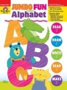
Jumbo Fun with the Alphabet, Grade Prek - 1, Teacher Reso...

Evan-Moor Corporation
Jumbo Fun with the Alphabet, Grade Prek - 1, Teacher Resource
Jumbo Fun with the Alphabet is your ultimate resource for teaching letter names and sounds! Over 200 pages of engaging activities help students see, hear, say, and write the 26 letters of the alphabet while they develop the important reading readiness skills of alphabetic awareness, print awareness, phonemic awareness, and visual discrimination.