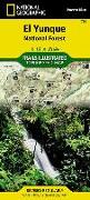
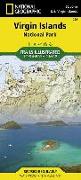
Coverage includes Bano de Oro Research Natural Area, El Yunque Recreation Area, Sierra de Luquillo. Includes UTM grids for use with your GPS unit and a trail matrix.
Coverage includes Jefferson National Forest, Blacksburg, Radford, Pulaski, Bluefield, Wytheville. Wilderness areas include Beartown, Kimberling Creek, Peters Mountain, Mountain Lake. Also includes the Appalachian National Scenic Trail. Includes UTM tick marks for use with your GPS unit and a trail mileage matrix.
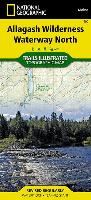
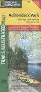
National Geographic's Trails Illustrated Maps are the most detailed and up-to-date topographic recreation maps available for US National Parks, National Forests and other popular outdoor recreation areas. A necessity for exploring the outdoors, each map is printed on waterproof, tear-resistant material. They also contain key safety and contact information, GPS and compass coordinates, Leave No Trace ethical guidelines and hundreds of points-of...
National Geographic's Trails Illustrated Maps are the most detailed and up-to-date topographic recreation maps available for US National Parks, National Forests and other popular outdoor recreation areas. A necessity for exploring the outdoors, each map is printed on waterproof, tear-resistant material. They also contain key safety and contact information, GPS and compass coordinates, Leave No Trace ethical guidelines and hundreds of points-of...
National Geographic's Trails Illustrated Maps are the most detailed and up-to-date topographic recreation maps available for US National Parks, National Forests and other popular outdoor recreation areas. A necessity for exploring the outdoors, each map is printed on waterproof, tear-resistant material. They also contain key safety and contact information, GPS and compass coordinates, Leave No Trace ethical guidelines and hundreds of points-of...
Coverage includes Virgin Mountains, Black Mountains, Valley of Fire State Park, North Muddy Mountains, Detrital Valley, Newberry Mountains, El Dorado Mountains, White Hills, Mt. Wilson Wilderness Hoover Dam. Towns: Boulder City, Overton. Includes UTM grids for use with your GPS unit.
Coverage includes Cherokee National Forest/Northern Districts, Greenville and Newport, and Sampson Mountain Wilderness Area. Boating Access Points: Nolichucky and French Broad Rivers. Scenic Drives: Foothills Parkway. Includes coverage of the Appalachian Trail. Includes UTM grids for use with your GPS unit and a trail mileage matrix.
National Geographic's Trails Illustrated Maps are the most detailed and up-to-date topographic recreation maps available for US National Parks, National Forests and other popular outdoor recreation areas. A necessity for exploring the outdoors, each map is printed on waterproof, tear-resistant material. They also contain key safety and contact information, GPS and compass coordinates, Leave No Trace ethical guidelines and hundreds of points-of...
National Geographic's Trails Illustrated Maps are the most detailed and up-to-date topographic recreation maps available for US National Parks, National Forests and other popular outdoor recreation areas. A necessity for exploring the outdoors, each map is printed on waterproof, tear-resistant material. They also contain key safety and contact information, GPS and compass coordinates, Leave No Trace ethical guidelines and hundreds of points-of...
National Geographic's Trails Illustrated Maps are the most detailed and up-to-date topographic recreation maps available for US National Parks, National Forests and other popular outdoor recreation areas. A necessity for exploring the outdoors, each map is printed on waterproof, tear-resistant material. They also contain key safety and contact information, GPS and compass coordinates, Leave No Trace ethical guidelines and hundreds of points-of...
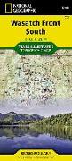
Coverage includes Uinta National Forest, Mt. Nebo, Lone Peak and Mt. Timpanogos Wildernesses, Granite, American Fork, Orem, Little Cottonwood Canyon, Santaquin, Devils Kitchen, Deer Creek and Silver Lake Flat reservoirs and Little Provo River. Includes UTM tick marks for use with your GPS unit.
Coverage includes Wasatch-Cache National Forest, the entire High Uintas Wilderness and surrounding backcountry, Hoop, Brown, Moon, Crystal, Little Lyman and Atwood lakes, Paradise Park, Cedar View, Upper Stillwater and Whitney reservoirs, Red Knob, Squaw, Smith Fork, Anderson, and Thompson passes. Includes UTM grids for use with your GPS unit.
National Geographic's Trails Illustrated Maps are the most detailed and up-to-date topographic recreation maps available for US National Parks, National Forests and other popular outdoor recreation areas. A necessity for exploring the outdoors, each map is printed on waterproof, tear-resistant material. They also contain key safety and contact information, GPS and compass coordinates, Leave No Trace ethical guidelines and hundreds of points-of...
National Geographic Wall Maps offer a special glimpse into current and historical events, and they inform about the world and environment. Offered in a variety of styles and formats, these maps are excellent reference tools and a perfect addition to any home, business or school. There are a variety of map options to choose from, including the world, continents, countries and regions, the United States, history, nature and space.
National Geographic's Trails Illustrated Maps are the most detailed and up-to-date topographic recreation maps available for US National Parks, National Forests and other popular outdoor recreation areas. A necessity for exploring the outdoors, each map is printed on waterproof, tear-resistant material. They also contain key safety and contact information, GPS and compass coordinates, Leave No Trace ethical guidelines and hundreds of points-of...
National Geographic's Trails Illustrated Maps are the most detailed and up-to-date topographic recreation maps available for US National Parks, National Forests and other popular outdoor recreation areas. A necessity for exploring the outdoors, each map is printed on waterproof, tear-resistant material. They also contain key safety and contact information, GPS and compass coordinates, Leave No Trace ethical guidelines and hundreds of points-of...
National Geographic's Trails Illustrated Maps are the most detailed and up-to-date topographic recreation maps available for US National Parks, National Forests and other popular outdoor recreation areas. A necessity for exploring the outdoors, each map is printed on waterproof, tear-resistant material. They also contain key safety and contact information, GPS and compass coordinates, Leave No Trace ethical guidelines and hundreds of points-of...
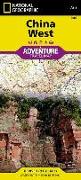
AdventureMaps provide global travellers with the perfect combination of detail and perspective, highlighting hundreds of points of interest and the diverse and unique destinations within the country. Each map is printed on durable synthetic paper, making them waterproof and tear-resistant. They also include the locations of cities and towns with a user-friendly index, plus a clearly marked road network complete with distances and designations ...

![Clinch Ranger District Map [Jefferson National Forest]](https://support.digitalhusky.com/media/annotations/sorted/107/1071404/CHSBZCOP031071404.jpg)
![Blacksburg, New River Valley Map [George Washington and Jefferson National Forests]](https://support.digitalhusky.com/media/annotations/sorted/107/1071397/CHSBZCOP031071397.jpg)
![Mount Baker and Boulder River Wilderness Areas Map [Mt. Baker-Snoqualmie National Forest]](https://support.digitalhusky.com/media/annotations/sorted/108/10860847/CHSBZCOP0310860847.jpg)
![Boundary Waters West Map [Canoe Area Wilderness, Superior National Forest]](https://support.digitalhusky.com/media/annotations/sorted/108/10860845/CHSBZCOP0310860845.jpg)
![French Broad and Nolichucky Rivers Map [Cherokee and Pisgah National Forests]](https://support.digitalhusky.com/media/annotations/sorted/108/10860821/CHSBZCOP0310860821.jpg)
![Boundary Waters East Map [Canoe Area Wilderness, Superior National Forest]](https://support.digitalhusky.com/media/annotations/sorted/108/10860844/CHSBZCOP0310860844.jpg)
![Salt River Canyon Map [Tonto National Forest]](https://support.digitalhusky.com/media/annotations/sorted/108/10860841/CHSBZCOP0310860841.jpg)
![Mazatzal and Pine Mountain Wilderness Areas Map [Coconino, Prescott, and Tonto National Forests]](https://support.digitalhusky.com/media/annotations/sorted/108/10860840/CHSBZCOP0310860840.jpg)
![High Uintas Wilderness Map [Ashley and Wasatch-Cache National Forests]](https://support.digitalhusky.com/media/annotations/sorted/108/10860816/CHSBZCOP0310860816.jpg)

![Baxter State Park Map [Mount Katahdin, Katahdin Iron Works]](https://support.digitalhusky.com/media/annotations/sorted/109/10977059/CHSBZCOP0310977059.jpg)