Suche einschränken:
Zur Kasse

5934 Ergebnisse - Zeige 1 von 20.

Akcaabatin Kadim Yerleskesi Kordyle

Topal, Zehra
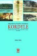
Akcaabatin Kadim Yerleskesi Kordyle
Insanoglunun gecmisini arama ve ögrenme arzusu, varolussal bir cabanin ürünüdür. Belki de bu sayede, gözünü yalniz olarak dünyaya acmis olmasina bir anlam kazandirmayi, kurmaya calistigi baglantilarla toplumsallasmasini saglayabilmeyi, dolayisiyla yalnizliktan kurtulmayi amaclamaktadir.Gecmisi antik caglara kadar uzanan Trabzon ve hinterlandinin tarihsel süreci, yörede dogup büyüyenlerin aidiyetini ortaya koymasi bakimindan hemen herkesin ilgi...

CHF 23.90

Bob Marshall Wilderness Map

National Geographic Maps
Bob Marshall Wilderness Map
- Waterproof - Tear-Resistant - Topographic MapExplore the wonders of the Bob Marshall Wilderness Complex with National Geographic's Bob Marshall Wilderness Trails Illustrated Map. This area includes four national forests and the Great Bear, Bob Marshall, and Scapegoat Wilderness Areas. Encompassing the highest concentration of grizzlies in the continental U.S., this region extends from Seeley Lake in the South to the northern tip of Hungry Ho...

St George, Pine Valley Mountain Map

National Geographic Maps
St George, Pine Valley Mountain Map
- Waterproof - Tear-Resistant - Topographic MapThis map covers the Pine Valley Ranger District of Dixie National Forest, a high-elevation mountain sanctuary from the hot, southern Utah desert that surrounds it. Coverage extends from the Kolob Canyons area of Zion National Park in the northeast to Saint George, Utah to the south, and the Nevada state line to the west. Key features are the Pine Valley Recreation Area, ideal for hiking, horseback...

Goat Rocks, Norse Peak and William O. Douglas Wilderness ...

National Geographic Maps
Goat Rocks, Norse Peak and William O. Douglas Wilderness Areas Map [Gifford Pinchot, Mt. Baker-Snoqualmie, and Okanogan-Wenatchee National Forests]
National Geographic's Trails Illustrated Maps are the most detailed and up-to-date topographic recreation maps available for US National Parks, National Forests and other popular outdoor recreation areas. A necessity for exploring the outdoors, each map is printed on waterproof, tear-resistant material. They also contain key safety and contact information, GPS and compass coordinates, Leave No Trace ethical guidelines and hundreds of points-of...

Mount Hood Map [Mount Hood and Willamette National Forests]

National Geographic Maps
Mount Hood Map [Mount Hood and Willamette National Forests]
National Geographic's Trails Illustrated Maps are the most detailed and up-to-date topographic recreation maps available for US National Parks, National Forests and other popular outdoor recreation areas. A necessity for exploring the outdoors, each map is printed on waterproof, tear-resistant material. They also contain key safety and contact information, GPS and compass coordinates, Leave No Trace ethical guidelines and hundreds of points-of...

Springer and Cohutta Mountains Map [Chattahoochee Nationa...

National Geographic Maps
Springer and Cohutta Mountains Map [Chattahoochee National Forest]
National Geographic's Trails Illustrated Maps are the most detailed and up-to-date topographic recreation maps available for US National Parks, National Forests and other popular outdoor recreation areas. A necessity for exploring the outdoors, each map is printed on waterproof, tear-resistant material. They also contain key safety and contact information, GPS and compass coordinates, Leave No Trace ethical guidelines and hundreds of points-of...

Fontana and Hiwassee Lakes Map [Nantahala National Forest]

National Geographic Maps
Fontana and Hiwassee Lakes Map [Nantahala National Forest]
National Geographic's Trails Illustrated Maps are the most detailed and up-to-date topographic recreation maps available for US National Parks, National Forests and other popular outdoor recreation areas. A necessity for exploring the outdoors, each map is printed on waterproof, tear-resistant material. They also contain key safety and contact information, GPS and compass coordinates, Leave No Trace ethical guidelines and hundreds of points-of...

Essential Teachings of Maitreya

Jinpa, Dorje
Essential Teachings of Maitreya
Just as in autumn on a cloudless day the image of the moon can be seen reflected in a pond, so the disciples of the Buddha perceived the manifestation of the omnipresent reflected in the body of the Buddha.If the Buddha-Nature did not exist there would be no impulse to be liberated from the suffering of samsara and no heartfelt attraction to nirvana. Samsara is full of suffering and is therefore impure. Nirvana is bliss and therefore has merit...

CHF 28.50

Skyline Boulevard Map

National Geographic Maps
Skyline Boulevard Map
- Waterproof - Tear-Resistant - Topographic MapRunning along the side of the Santa Cruz Mountains, Skyline Boulevard is known for its scenic attractions and unlimited recreational opportunities. Outdoor enthusiasts exploring this California Scenic Byway and surrounding area will find National Geographic's Trails Illustrated map of Skyline Boulevard and indispensable tool. Expertly researched and created in partnership with Midpeninsula Regiona...

Big Basin, Santa Cruz Map

National Geographic Maps
Big Basin, Santa Cruz Map
- Waterproof - Tear-Resistant - Topographic MapExpertly researched and created in partnership with local land management agencies, National Geographic's Trails Illustrated map of Big Basin, Santa Cruz provides an unparalleled tool for exploring this landscape of redwood forests and picturesque California coastline. Some of this map's key points of interest include Lexington Reservoir, Loch Lomond, and Big Basin, The Forest of Nisene Marks, Wil...

Slovakia Map

National Geographic Maps
Slovakia Map
- Waterproof - Tear-Resistant - Travel MapNational Geographic's Slovakia Adventure Map is designed to meet the needs of adventure travelers with its detailed, accurate information and user-friendly design. Cities and towns are easy to find with the map's helpful index. Motorways, expressways, and other roads are clearly designated and include distance in kilometers so travelers can easily plan their best route. Specialty content such as hundre...

Issaquah Alps, Mount Si Map

National Geographic Maps
Issaquah Alps, Mount Si Map
- Waterproof - Tear-Resistant - Topographic MapNational Geographic's Trails Illustrated map of the Issaquah Alps and Mount Si provides unparalleled detail for outdoor enthusiasts seeking to explore the endless recreational opportunities in this area just east of Puget Sound. Expertly researched and created in partnership with King County, Washington DNR and others, the map covers tens of national, state and regional recreation areas. Coverage ...

Allegheny South Map [Allegheny National Forest]

National Geographic Maps
Allegheny South Map [Allegheny National Forest]
- Waterproof - Tear-Resistant - Topographic MapExplore the forests, valleys, and winding rivers of northwestern Pennsylvania with National Geographic's Trails Illustrated map of Allegheny South. Expertly researched and created in partnership with local land management agencies, this map is a valuable tool for those seeking a relaxing day trip and outdoor adventurers alike. Key areas of interest featured on this map include Hickory Creek Wilder...

Allegheny North Map [Allegheny National Forest]

National Geographic Maps
Allegheny North Map [Allegheny National Forest]
- Waterproof - Tear-Resistant - Topographic MapNational Geographic's Trails Illustrated map of Allegheny North delivers unmatched detail and valuable information to assist you in your exploration of this scenic national forest. Year-round recreation activities abound in the Allegheny National Recreation Area, Hickory Creek Wilderness, Chapman State Park, Allegheny Islands Wilderness, Kinzua Creek, and Tionesta and Hearts Content scenic areas. ...